Updated on: May 25, 2025
You want to know if a particular road or stop is within a five-mile radius of another place. You hop onto Google Maps, enter the address, but wait, you can’t draw a distance circle!
Talking about a business use case, as a fleet manager, you would want to know how far your delivery team can travel within a ten-mile radius of your store or warehouse. Being able to draw a distance circle on Google Maps would really make your life easier.
Unfortunately, it doesn’t offer a map radius tool to draw a distance circle. However, with the right tips and tools, you can easily draw a circle and understand the proximities of any address stops.
How to Draw a Distance Circle on Google Maps:
Let’s take a look at the simple steps you need to follow to draw a distance circle on Google Maps:
- Step: Go to Google Maps.
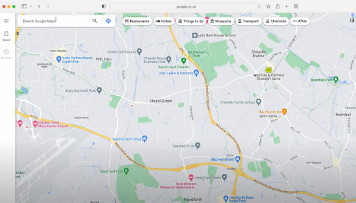
- Step: Enter the address around which you want to draw the radius. You’ll realize there is no built-in feature to directly draw circles with a specific distance in Google Maps.

- Step: Go to the Map Developers website.

- Step: Head to the Map Tools option in the menu bar and select the Draw Circle Tool.

- Step: In the Address bar, type in the location name along with the desired radius of the circle.

- Step: After you’ve put in the required details, click the New Circle button.

- Step: You can see the distance circle around the location you wanted.

- Step: You can zoom in and check if a particular road or location falls within the given circle.

Also Read: How to use Google Maps Route Planner For Deliveries?
increase fuel savings
Hassle Free Deliveries & Pickups!
Optimize routes with our algorithm, reducing travel time and costs efficiently.
Get Started for Free
When Would You Need to Draw a Distance Circle?
Adding a distance radius to your Google Maps view helps visualize geographic limits. You can figure out the proximities of a particular location. Drawing a distance radius helps remove the guesswork. With a clear visual, you can make better, faster decisions.
Here are a few practical use cases:
- Delivery Route Planning
Drawing a distance radius helps you define delivery zones based on distance from a warehouse or store. You can instantly identify all stops within a 5, 10, or 15-mile radius and plan multiple drop-offs more efficiently, reducing unnecessary miles and fuel usage. - Territory Assignment
Fleet managers can assign drivers based on coverage zones. With a clear map radius, it’s easy to ensure routes don’t overlap, each driver has a balanced workload, and no area is left uncovered. - Emergency Dispatch and Quick Turnaround Jobs
When time-sensitive jobs come in, you can quickly see which driver is closest within a set radius. This helps assign urgent tasks faster and improves overall response times. - Service Availability Checks
Before accepting a new job or service request, check if it falls within your operational radius. This keeps delivery promises realistic and avoids last-minute cancellations due to distance issues. - Strategic Expansion Planning
Planning to add a new depot or warehouse? Distance radius tools help assess potential coverage areas from new locations and decide if the investment will effectively support your growth goals.
Conclusion:
Drawing a distance radius on Google Maps is a small step that delivers big insights. Whether you’re organizing deliveries, analyzing service zones, or simply planning your travel, it adds a layer of clarity to your map.
With the help of a trusted Map Radius Tool, you can instantly visualize your reach and make location-based decisions with confidence. It’s a smart way to turn basic navigation into meaningful planning.
Are you a fleet owner?
Want to manage your drivers and deliveries easily?
Grow your business effortlessly with Zeo Routes Planner – optimize routes and manage multiple drivers with ease.
increase fuel savings
Save 2 Hours on Deliveries, Everyday!
Optimize routes with our algorithm, reducing travel time and costs efficiently.
Get Started for Free