Road trip planning can be exciting and Google Maps gives you live navigation which is capable of taking you almost anywhere in the world. It transforms your journey into a seamless and satisfying experience. To make your road trip smoother and more enjoyable Google Maps offers the best features.
In this blog post, we will discuss the top features of Google Maps that can significantly enhance your road trip.
-
Route Planning and Multiple Stops
Route planning with multiple stops using Google Maps is simple and highly effective. Multiple stops in Google Maps allow you to add multiple destinations to your route. For choosing the best fit for your needs the alternate routes provide different options.
Now let’s see the steps for route planning and multiple stops. Install the Google Maps app, then tap on the search bar and enter your starting location. Now enter your first destination by tapping on “Directions”.
Add multiple stops by tapping the three-dot menu icon in the top right corner then select “Add stop.” To add more stops enter the next destination and repeat this process. Now rearrange stops by tapping and holding the three horizontal lines next to each stop to drag them. Choose the route options by tapping on the options button next to the starting point.
Review your route and make sure all stops are correct start the navigation by tapping on “Start”.
-
Real-Time Traffic Updates
Another best feature of Google Maps is real-time traffic updates which helps to avoid traffic jams and delays with live traffic information. The feature can predict traffic conditions based on historical data to choose the optimal departure time. Google Maps gathers data and provides your real-time location on the map including estimated travel times and current traffic speeds.
-
Save maps to your phone
Google Maps has a saving maps feature which is very travel-friendly. You can effectively plan and organize your road trips, also you can ensure that all the places you want to visit are easily accessible.
Now let’s see how to save maps to your phone. Firstly, tap the “Saved” tab at the bottom of the Google Maps. Create new lists, then the homepage will pop up with an “Add” button you can use to find locations. Tap “Save” and select the list that needs to be added.
-
Download maps to use offline
Google Maps has an offline maps feature which is useful for road trips, especially in areas where internet connectivity is unreliable or unavailable. Here’s how to download maps for offline use and some tips for maximizing their utility.
To use this feature,

increase fuel savings
Save $200 on fuel, Monthly!
Optimize routes with our algorithm, reducing travel time and costs efficiently.
Get Started for Free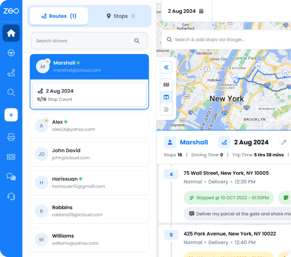
- Select the profile picture in the top right corner of the screen.
- Then tap on “Offline maps,”.
- Then choose “Select your map.”
- Zoom in or out on the map to select the area you’d like to have access to when offline and then tap “Download.”
- Now you can use it to navigate without any internet connectivity.
-
Figure out the best time to visit a place
Figuring out the best time to visit a place using Google Maps involves checking several features. They provide information on popular times, peak times, and seasonal trends. Once you’ve decided on your road trip on Google Maps, you’ll find a chart showing popular times. It also shows you how busy the place typically is during different times of day. You can even see how busy a place is right now so you can save time and avoid long lines.
Learn More: Google Maps Route Navigation
Some Advantages Of Google Maps
Real-time traffic updates: Google Maps provides real-time updates on traffic situations. It highlights the high-traffic parts of the route as red and helps you plan your routes more efficiently and avoid traffic jams.
Auto re-routing: With auto re-routing, Google Maps is actively working to keep you on the right track. It enhances the overall navigation experience and updated info about tolls & road closures.
Different transportation modes: Google Maps supports various transportation modes and provides detailed directions. Suggestions make it easy to navigate using your preferred method of transportation.
Read More: Google Maps Route Planner App: 7 Reasons It Won’t Make Your Journey Seamless
Final Thoughts
Google Maps has great advantages and features, it optimizes the routes with more than two addresses. It gives you the most efficient route between start and end locations.
If you are looking for the best route for a road trip with multiple locations, Google Maps will help by integrating with Zeo Route Planner. Route optimization helps you to find the most efficient in terms of distance, time, and cost. It can further optimize your routes, ensuring you reach your destinations with maximum efficiency. By leveraging the power of both platforms, you can streamline your travel planning process and enjoy smoother journeys.
Schedule a free demo with us to learn more about Google Maps with Zeo to optimize your road trip.
Are you a fleet owner?
Want to manage your drivers and deliveries easily?
Grow your business effortlessly with Zeo Routes Planner – optimize routes and manage multiple drivers with ease.
increase fuel savings
Save 2 Hours on Deliveries, Everyday!
Optimize routes with our algorithm, reducing travel time and costs efficiently.
Get Started for Free