Updated on: May 18, 2026
A Comprehensive Guide to Drawing Circles and Radii on Google Maps
From logistics business to catering services efficient route planning is crucial.
Knowing the exact reach of your services can help you optimize routes, save time, and reduce costs. Drawing a radius on Google Maps is a powerful way to visualize and plan your service areas effectively. When it comes to visualizing geographic data, Google Maps is a powerful map radius tool that allows users to understand spatial relationships and distances effortlessly. In this blog post we will dive deeper into drawing radius and circles on google maps.
Why do people use Google Maps to draw a Radius?
Drawing radius and circles on Google Maps help to visualize distances from a specific point. This helps in tasks like assessing market potential, organizing events, and planning service areas, estimating travel times. Here are some ways that many different industries can profit:
#1. Logistics
Delivery scheduling and efficient route are essential for logistics industry to minimise the cost and to ensure timely delivery. Google Maps helps logistics companies to optimize delivery routes and to understand the reach of their distribution centers. A logistics company can draw a 50-mile radius around a distribution center to identify areas reachable within two hours, helping plan faster routes, ensure timely deliveries, and cut fuel costs.
#2. Field Sales
In field sales industry, the team often need to visit multiple prospects within a specific area.
Drawing a radius on Google Maps helps sales managers to plan and optimize their team’s routes. This helps to ensure that each representative covers their designated territory efficiently.
#3. Catering Services
To sustain in catering service business it is crucial to ensure that the food delivered is fresh and delivered on time. The catering companies define their service areas by drawing a radius on Google Maps. It can manage delivery times, and optimize their routes for maximum efficiency. Thus a catering company can draw a radius around its kitchen to define the ideal delivery area, helping ensure food stays fresh.
#4. Wholesale Distribution
Wholesale distributors need to manage deliveries to various retailers and businesses efficiently. Drawing a radius on Google Maps around their warehouses helps them understand their delivery reach and plan routes that optimize delivery times and reduce transportation costs.
increase fuel savings
Save 2 Hours on Deliveries, Everyday!
Optimize routes with our algorithm, reducing travel time and costs efficiently.
Get Started for Free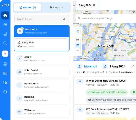
A wholesale distributor can draw a 30-mile radius around their main warehouse to identify which retailers can be served within a one-hour drive. The map radius tool helps in planning efficient delivery schedules, ensuring timely deliveries, and reducing overall logistics costs.
How to Draw a Radius and Circles on Google Maps: Step-by-Step
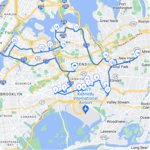
By adding multiple destinations and drawing a radius on Google Maps, you can easily measure the distance between a central point and nearby stops or markers within that area.
To draw a radius and circles on Google Maps, you can follow these steps:
- Open Google Maps on your computer or mobile device.
- Search for the location you want to create a radius around.
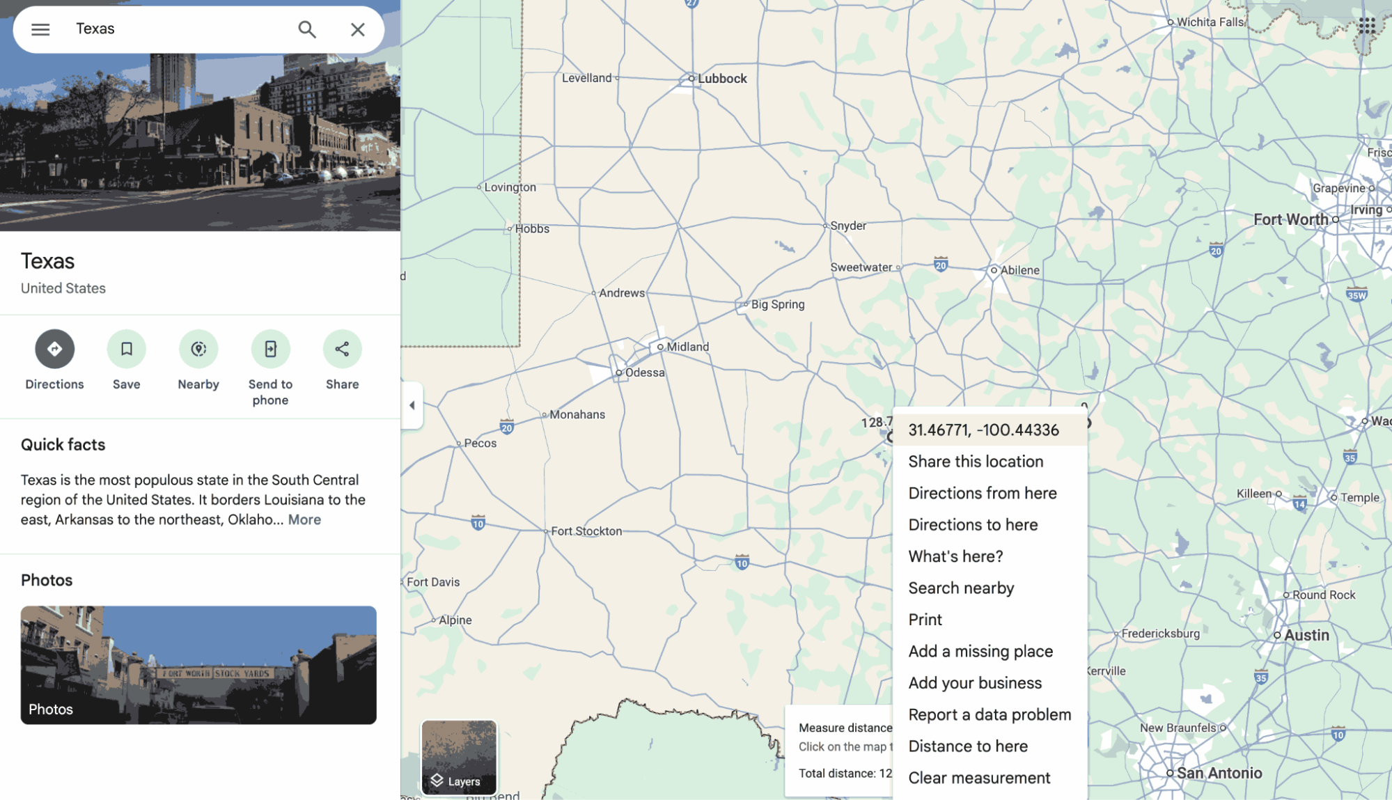
- Right-click on the location and select “Measure distance” from the menu.
- Click on the map to create a starting point for your radius.
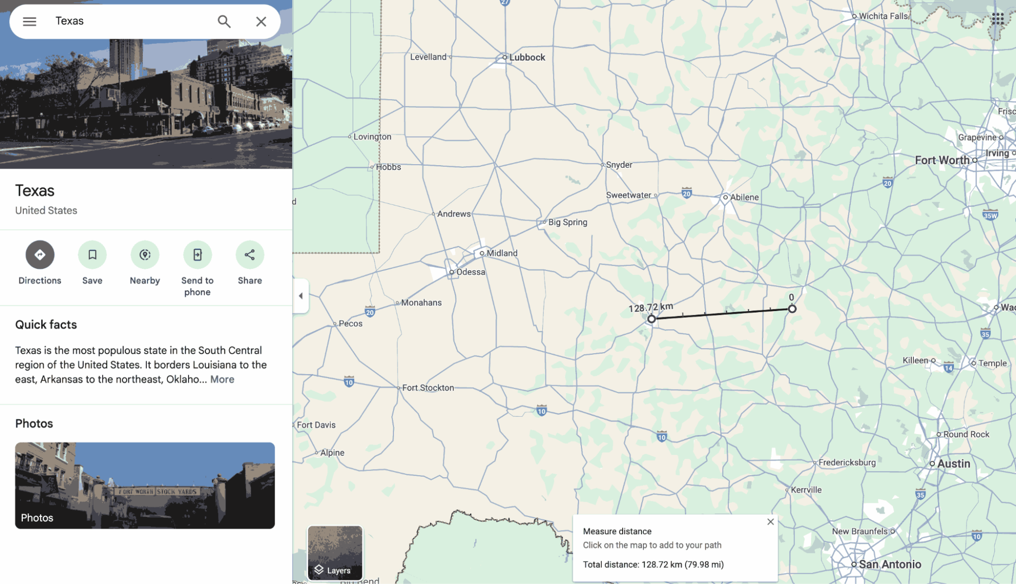
- Right-click and select “Measure distance”: Right-click on the desired location on the map and choose “Measure distance” from the context menu.
- You will see longitude and latitude numbers. Copy them and keep them for later use.
- Use a trusted third-party tool like KML4Earth (https://kml4earth.appspot.com/tools.html) to map a radius circle.
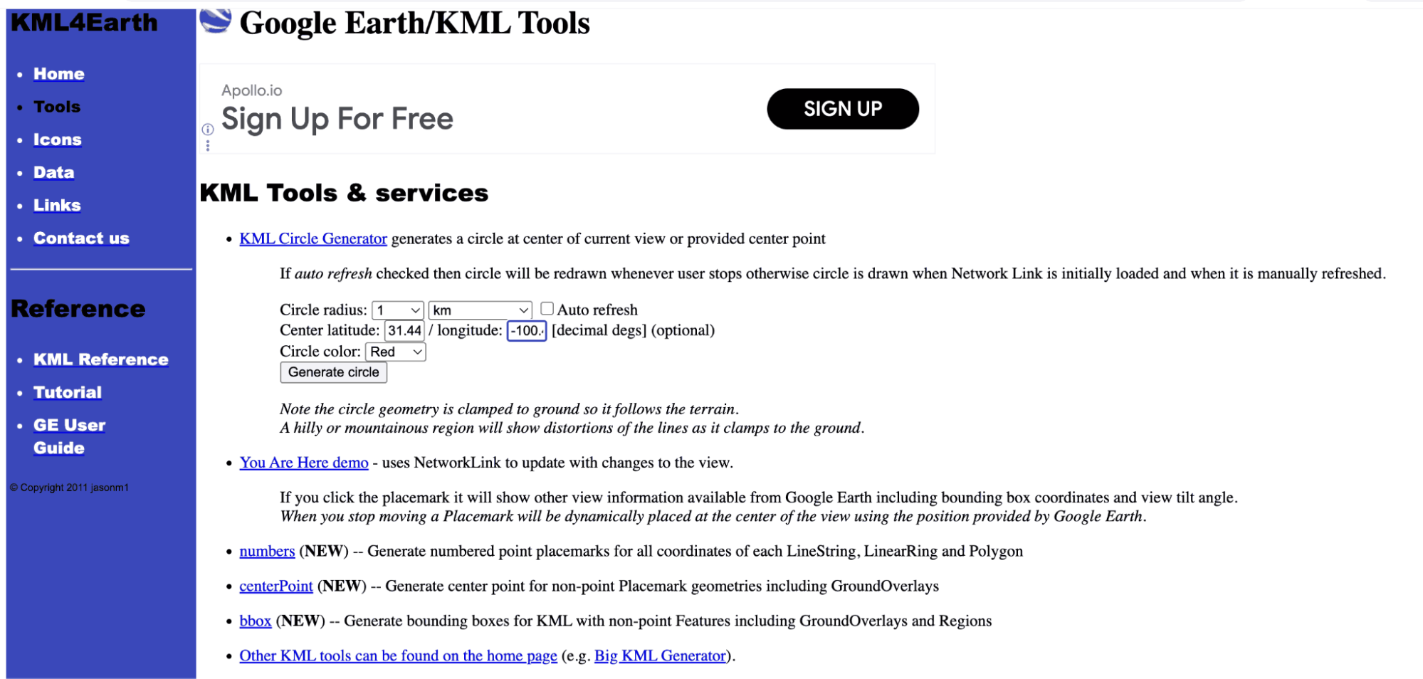
- Now, input coordinates we saved earlier.
- Select the color of your choice. Once done, hit “Generate Circle.”
- The tool will generate a KML file of the details you mentioned and save it in the “Download” section.
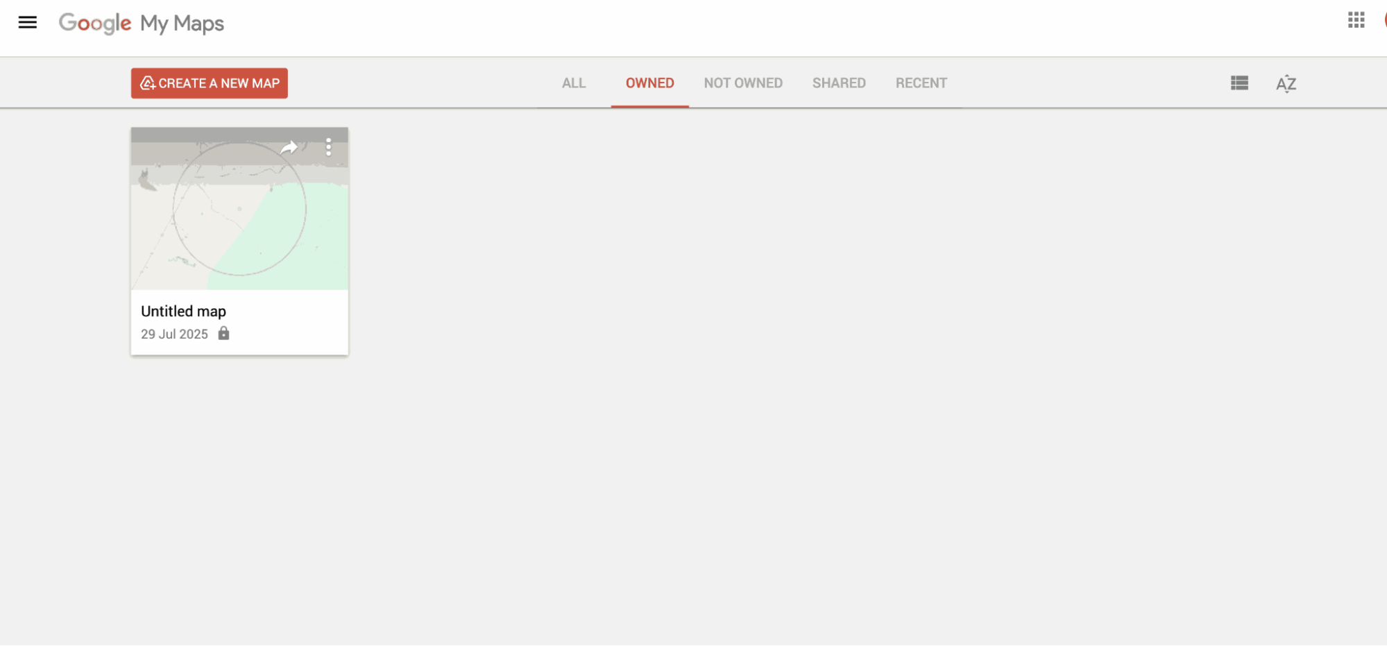
- Visit Google My Maps on desktop or mobile by searching on a web browser or clicking on this link: (https://www.google.com/mymaps)
- Now, click on the “Import” button right below the layer’s name and import the KML file you downloaded earlier.
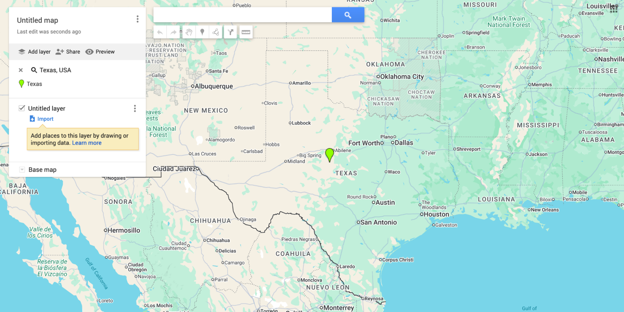
- As you upload the file, the maps will take you to the location of the coordinates you added and create a circle of the size you selected.
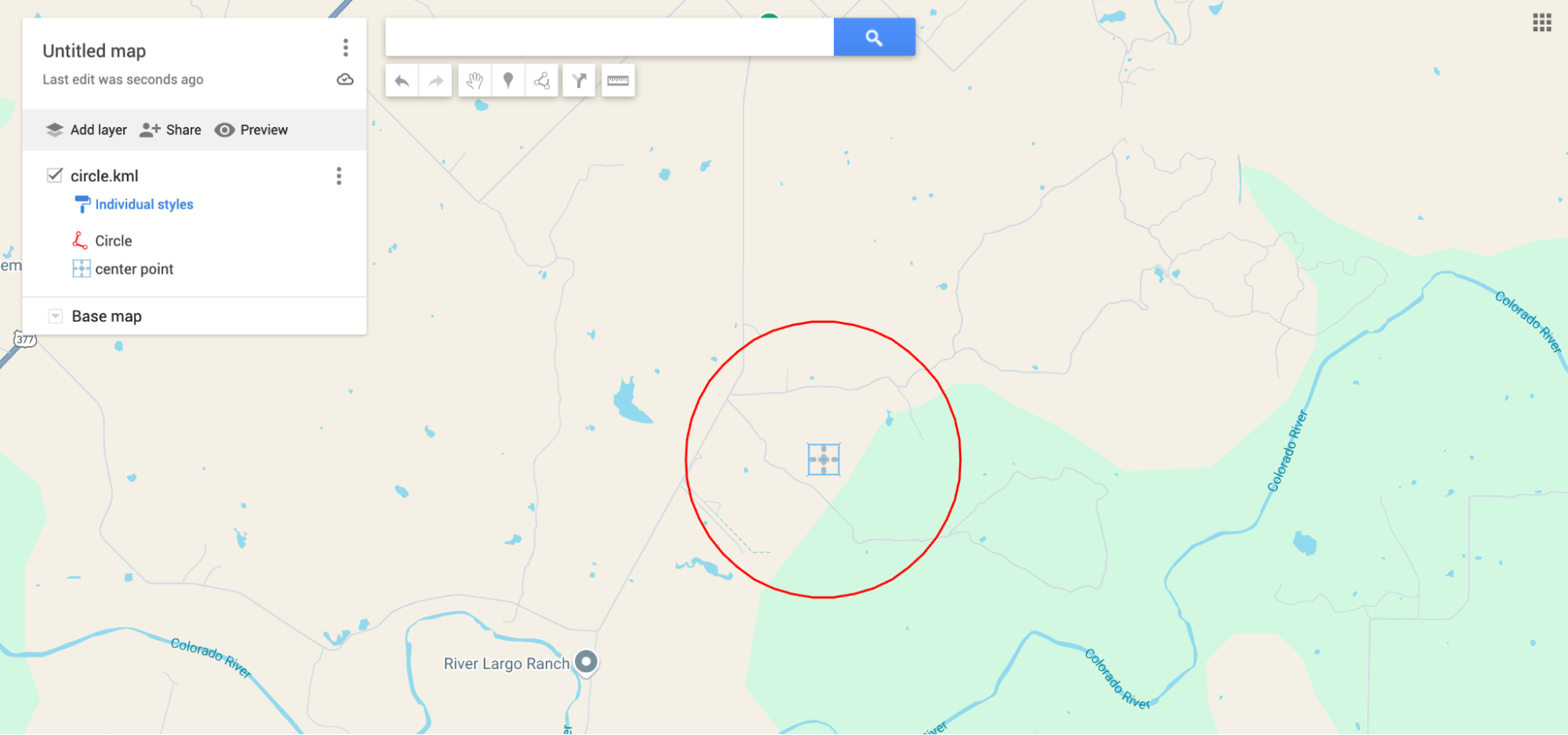
Now that you’ve made a custom radius on Google Maps, it’s ideal for organising delivery zones, service regions, or event borders.
Conclusion
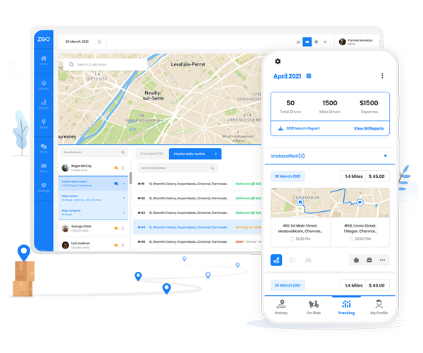
Drawing a radius or circle on Google Maps is a practical skill that can provide significant insights for various applications, from business and urban planning to personal use. Zeo Route Planner stands out as an ideal route-planing solution, offering seamless integration with Google Maps. You can power up your Google Maps navigation with Zeo and enhances operational efficiency and customer satisfaction.
Schedule a free demo with our experts to understand how Zeo will help you leverage Google Maps to optimize your route.
Are you a fleet owner?
Want to manage your drivers and deliveries easily?
Grow your business effortlessly with Zeo Routes Planner – optimize routes and manage multiple drivers with ease.
increase fuel savings
Hassle Free Deliveries & Pickups!
Optimize routes with our algorithm, reducing travel time and costs efficiently.
Get Started for Free