Updated on: March 9, 2026
Reading Time: 4 minutes
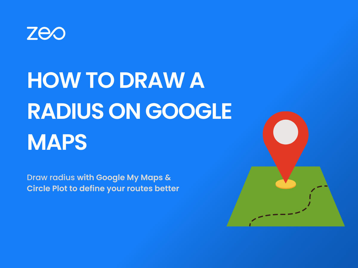
TL;DR: Google Maps doesn’t natively support drawing radius circles, but you can create them using Google My Maps combined with the Circle Plot tool to generate KML files. This combination allows businesses to visualize service areas, analyze market potential, and plan coverage zones effectively. Route optimization tools like Zeo Route Planner address location-based planning needs with capacity-based routing and service area management, helping delivery teams save 2+ hours daily.
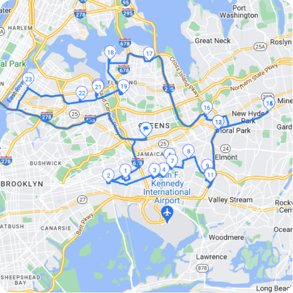
From navigation to business planning, Google Maps has become an indispensable tool for various purposes. It is user-friendly and can be used both on desktop and mobile phones. The tool has plenty of features, yet there is room for improvement. For example: Drawing a radius on Google Maps still isn’t an option.
A radius on a map allows users to visualize and analyze areas with a specified distance from a specific point.
In this blog, we will guide you through the process of drawing a radius using Google My Maps and Circle Plot.
Let’s dive in.
Why Do You Need a Map Radius?
Drawing a radius on a map can be beneficial for various reasons. Here are a few common use cases:
Locating Service Areas: If you own a business that provides services within a specific distance, drawing a radius on a map helps you determine which areas fall within your service range. This is particularly crucial for delivery businesses, field service companies, and local service providers who need to clearly define their operational boundaries.
Analyzing Market Potential: By visualizing a radius around your business location, you can assess the potential customer base within a specific distance. This information can aid in marketing and expansion strategies. U.S. Census Bureau data shows that understanding geographic market boundaries is essential for business growth planning.
Planning Events: Knowing the proximity of attendees or potential venues can be crucial when organizing events or meetings. Drawing a radius can help you find suitable locations easily accessible to participants.
Real Estate and Property Research: Whether you’re a real estate agent or a prospective buyer, drawing a radius on a map can assist in identifying properties within a desired distance from amenities, schools, or other important locations.
Emergency Response Planning: Emergency services, healthcare facilities, and disaster response teams use radius mapping to determine coverage areas and response times. This helps ensure adequate service coverage across communities.
Logistics and Distribution: Companies with multiple distribution centers or warehouses use radius mapping to optimize territory assignments and minimize overlap between service zones. This approach helps reduce operational costs while maintaining service quality.
Are you a fleet owner?
Want to manage your drivers and deliveries easily?
It’s easy to grow your business with Zeo Routes Planner Fleet Management Tool – optimize your routes and manage multiple drivers at the same time.
What Do You Need to Know Before Using a Software to Create Map Radius?
Before diving into the process of drawing a radius on Google Maps, you need to keep the following in mind:
Familiarize Yourself with Google My Maps: Google My Maps is a free web-based mapping tool provided by Google. It allows users to create and customize their own maps, including drawing shapes, adding markers, and sharing maps with others. Make sure you have a Google account and are logged in before proceeding.
Understand the Circle Plot Tool: Circle Plot is a website that offers a simple and efficient way to draw a radius on Google Maps. It provides a user-friendly interface and enables you to customize the radius by specifying the center point, distance, and units of measurement.
Know Your Coordinate System: The process involves working with latitude and longitude coordinates. Understanding how these geographic coordinates work will help you accurately place your radius center point and verify the results.
increase fuel savings
Save 2 Hours on Deliveries, Everyday!
Optimize routes with our algorithm, reducing travel time and costs efficiently.
Get Started for Free
Consider File Management: You’ll be working with KML (Keyhole Markup Language) files, which are standard formats for geographic data. Ensure you have a designated folder for saving and organizing these files for future reference.
Read more: Top 4 Google Maps Alternatives to Streamline Last-Mile Delivery.
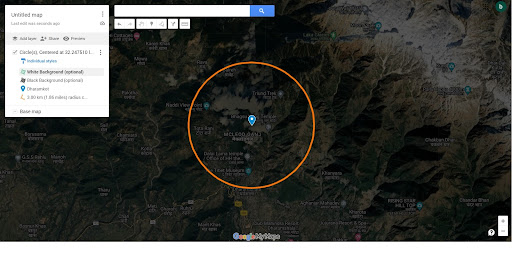
How to Use Google My Maps & Circle Plot to Create Map Radius?
Using My Maps & Circle Plot is a simple and effective way of plotting a map radius. The following steps will guide you through the process:
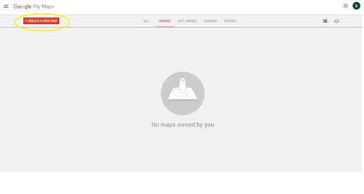
- Click Create a new map on the Google My Maps website.
- Search the required address and click on Add to map.
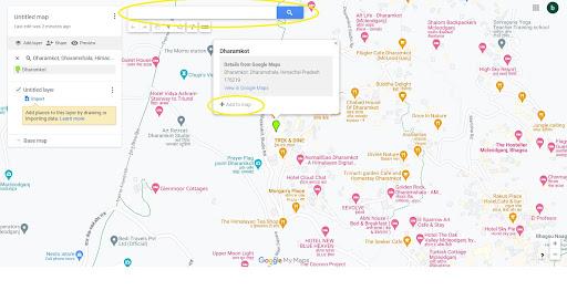
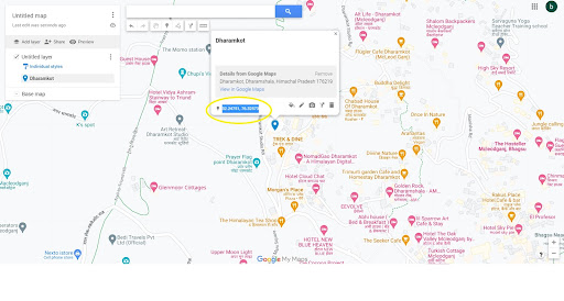
- Copy the latitude and longitude of the address.
- Visit the website of Circle Plot.
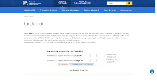
- Scroll down and enter the latitude and longitude
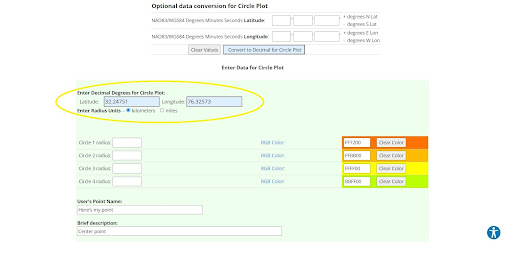
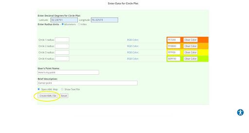
- Enter the radius and required details, then click Create KML File.
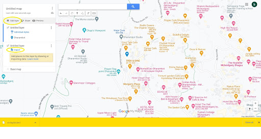
- A KML file will then be downloaded. Go to My Maps, click Add layer, then click Import.
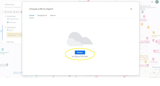
- Browse and choose the KML file, and click Open.
- The radius will appear on the map; you can export it if required
Advanced Tips for Radius Mapping
Once you’ve mastered the basic process of creating map radius circles, consider these advanced techniques to enhance your mapping capabilities:
Multiple Radius Layers: Create several radius circles with different distances from the same center point to show service tiers or pricing zones. This is particularly useful for delivery businesses that charge different rates based on distance.
Color Coding: Use different colors for various radius circles to distinguish between service types, priority zones, or operational areas. Google My Maps allows you to customize the appearance of each layer.
Combining with Other Data: Import additional data layers such as customer locations, competitor positions, or demographic information to create comprehensive business intelligence maps.
Regular Updates: Bureau of Labor Statistics data shows that business service areas often need adjustment based on market changes. Review and update your radius maps quarterly to reflect current operational capabilities.
Wrapping Up
Drawing a radius on Google Maps using Google My Maps and Circle Plot is a powerful way to visualize and analyze areas within a specified distance. Whether you’re a business owner, event planner, or real estate professional, this tool can provide valuable insights for decision-making. We hope the guide proves to be of good value for your time.
Additionally, consider checking out our product Zeo Route Planner if your business comprises delivery operations. Our route planning and fleet management solution goes a long way in streamlining last-mile delivery and optimizing delivery operations.
To learn more, book a free demo today!
Frequently Asked Questions
How accurate are radius circles created with Google My Maps and Circle Plot?
Radius circles created using Google My Maps and Circle Plot are highly accurate for most business applications, typically within a few meters of precision. The Circle Plot tool uses standard geographic calculations based on the WGS84 coordinate system, which is the same system used by GPS devices and most mapping applications.
Can I create multiple radius circles on the same map?
Yes, you can create multiple radius circles by generating separate KML files for each radius and importing them as different layers in Google My Maps. This allows you to visualize multiple service areas, compare coverage zones, or show different distance ranges from various center points.
What file formats can I export from Google My Maps after creating radius circles?
Google My Maps allows you to export your radius maps in KML, KMZ, and GeoJSON formats. You can also share the map publicly or privately, embed it on websites, or print it directly from the browser for offline use.
How do I determine the optimal service radius for my delivery business?
The optimal service radius depends on factors like vehicle capacity, traffic patterns, and delivery time commitments. Start by analyzing your current delivery data to identify average travel times and distances. Many businesses find success with 10-20 mile radius zones, but this varies significantly by location and industry type.
Is there software that combines radius mapping with actual route optimization?
Yes, dedicated route planning platforms like Zeo Route Planner combine service area visualization with AI-powered route optimization and capacity-based routing. These tools automatically assign stops to drivers within defined service areas while accounting for vehicle limits and time windows, helping businesses with 1.5M+ users optimize their delivery operations across 150+ countries.

Are you a fleet owner?
Want to manage your drivers and deliveries easily?
Grow your business effortlessly with Zeo Routes Planner – optimize routes and manage multiple drivers with ease.
increase fuel savings
Hassle Free Deliveries & Pickups!
Optimize routes with our algorithm, reducing travel time and costs efficiently.
Get Started for Free