Updated on: February 5, 2026
Reading Time: 5 minutes
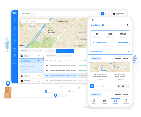
TL;DR: Google Maps doesn’t offer a built-in radius drawing tool, but third-party tools like FreeMapTools and Scribble Maps integrate with Google Maps to create radius circles for delivery zones and service areas. As of 2026, these tools help visualize coverage areas and optimize territory planning for field teams. Route optimization tools like Zeo Route Planner address this with capacity-based routing and service area management, helping delivery and service teams save 2+ hours daily.
Google Maps, one of the most widely used navigation platforms in the world is accessible on both mobile and desktop. It is super useful since it covers more than 98% of the globe as of 2026. It’s trusted for real-time directions, traffic updates, and pinpointing locations almost anywhere. But for all its features, there are some things it doesn’t offer out of the box.
One common request? The ability to draw a radius on Google Maps. Whether you’re planning delivery zones, setting up service areas, or just curious about how far a certain distance spans from a location, being able to draw a circle of a given radius would be incredibly useful.
Unfortunately, Google Maps doesn’t currently allow users to set or draw a radius directly within the app. That said, there are reliable ways to create one using free third-party tools—and once you know how, it’s surprisingly simple.
Let’s walk through exactly how to draw a radius on Google Maps, step by step.
Use Third-Party Tools to Draw a Radius on Google Maps
If you’re wondering how to draw a radius on Google Maps, the core truth is: you’ll need help from a third-party tool. Google Maps doesn’t support radius or drive-time features by default—but several free online tools do, and they integrate well with Google Maps.
These tools allow you to:
- Draw a circle of a given radius in miles or kilometers from any location
- Create drive-time polygons to visualize how far you can travel in a set time (e.g., 15 or 30 minutes)
- Determine which locations, addresses, or markers fall inside that area
- Export data or customer lists within the radius for business use
For example, the radius map tool allows users to determine distances between a location and specific markers that fall within the area. This tool will create a circle surrounding the specified point on your map, while the drive time option will produce a polygon shape. The polygon will include any areas within the specified time.
Steps to Draw a Radius Using Third-Party Tools
To create a radius on Google Maps, you’ll need a program that allows Google Maps integration. Open the program and find the map you’d like to use. Open the tools within the program and select the distance radius or drive time polygon tool. Select the starting location for your radius.
- Choose a tool that integrates with Google Maps.
Tools like Free Map Tools, MapDevelopers, or Scribble Maps are good options. - Open the tool and enter your starting location.
This could be an address, landmark, or GPS coordinate. This point becomes the center of your radius. - Select the radius or drive-time option
Some tools let you draw a perfect circle (radius in miles or km), while others support drive-time polygons based on road data.
- Set your radius distance or travel time
For example, you might choose “10 miles” or “20 minutes drive.” - Generate the map
The tool will highlight the area around your chosen point. - (Optional) Export data in radius.
If you’ve uploaded a list of customer addresses or store locations, you can filter and export only those within the selected area.
What Radius and Proximity Tools Can Show You
Radius tools calculate the distance between a central location and a defined boundary. This boundary can be based on a set distance (e.g., 10 miles) or drive time (e.g., 20 minutes).
If you’re trying to get a radius on Google Maps for planning, these tools help you visualize how far any location extends—and what’s inside that area.
This is useful for:
- Proximity analysis (e.g., which addresses fall within a delivery zone)
- Identifying coverage gaps
- Understanding travel distance from a hub
Single or Multiple Radius Options
Some Google Maps radius tools only allow one circle at a time. Others let you draw multiple radii simultaneously—handy if you’re working with multiple service locations or comparing areas.
For example:
If your sales team covers multiple cities, you might want to create a 25-mile radius around each city to evaluate territory overlap or customer distribution. This approach helps teams like those managing pool cleaning routes optimize their service areas across different regions.
This makes it easier to:
- Balance sales rep territories
- Spot underserved zones
- Plan route efficiency
Pro tip: Always confirm whether the tool supports multiple radii before committing to it.
increase fuel savings
Hassle Free Deliveries & Pickups!
Optimize routes with our algorithm, reducing travel time and costs efficiently.
Get Started for Free
Google Maps Integration:
When choosing a mapping tool, make sure it integrates with Google Maps. You want:
- Real-time updates from Google Maps data (traffic, routes, closures)
- Compatibility with mobile and desktop
- Cloud-based access so your team can collaborate
- Export options (for data filtering, customer location exports, etc.)
Some apps only work when open in a browser tab; others remain synced even when closed. Consider your workflow and how your team will access or update maps.
Choosing the Right Radius Mapping Tool for Your Team
When you’re managing teams across locations—whether it’s sales reps, field agents, or delivery drivers—you need more than just a map. You need a tool that lets you draw a radius on Google Maps, optimize routes, and define territories clearly.
Team-Based Access Matters
Make sure the tool you choose:
- Works across all devices (Android, iOS, desktops, tablets)
- Offers cloud-based access, so different team members can collaborate
- Supports user-specific logins or permissions if needed
Whether you’re working from a laptop in the office or a phone in the field, your mapping software should be flexible and responsive. For businesses managing complex service territories, like those using AI delivery management software, this accessibility becomes even more critical.
Prioritize Ease of Use Over Feature Overload
Some mapping programs promise everything—but if the interface is confusing, your team won’t use it.
Focus on:
- A clean, intuitive user experience
- Core features like drawing a radius, importing location data, or exporting customer lists
- Support for Google Maps integration with real-time updates
Start by listing what matters most: is it territory mapping? drive-time visualization? simple UI? Then match the tool to your real-world workflow.
Frequently Asked Questions
Let’s tackle some of the quick learning bottlenecks before trying to draw radius on Google Maps.
- Can I draw a radius on Google Maps directly?
No, Google Maps doesn’t offer a built-in radius tool. Though, you can use it to draw a circle of a given radius using third-party tools that integrate with Google Maps, such as Free Map Tools or MapDevelopers. - How do I get a radius on Google Maps for a delivery area?
Scribble Maps or Free Map Tools are good tools to get a radius for a delivery zone. You simply need to enter your store address, set the radius (in miles or kilometers), and generate the area. - Which tool lets Google Maps draw a circle with a specific radius?
Some of the popular tools that allow you to input a location and draw a Google Maps radius are:- FreeMapTools.com
- MapDevelopers
- Scribble Maps
- Can I set different radius sizes on the same map?
Yes. Some tools let you draw multiple radius on the same map with custom distances from different central points. - Are these radius tools free to use?
There are a few free for basic use tools that lets you draw a radius on Google Maps. Other, often paid versions, have advanced features like data export, territory management, or team access.
Conclusion
You cannot draw radius directly on Google Maps. But still, it is possible for you to create accurate, shareable radius maps using third-party tools. It can be for defining service areas, assigning sales territories, or planning delivery zones. You can use the tools and their features to fill up this gap.
Begin with choosing the tool that fits your needs, enter a location, set the distance, and visualize your area of interest.
For teams and businesses, choosing software with Google Maps integration, multi-device support, and a user-friendly design ensures everyone stays on the same page—literally.
Are you a fleet owner?
Want to manage your drivers and deliveries easily?
Grow your business effortlessly with Zeo Routes Planner – optimize routes and manage multiple drivers with ease.
increase fuel savings
Hassle Free Deliveries & Pickups!
Optimize routes with our algorithm, reducing travel time and costs efficiently.
Get Started for Free