

# Dæmisaga um hagræðingu leiða stjórnvalda: Raunveruleg arðsemi fjárfestingar
> TL; DR: Municipal agencies using route optimization achieve 20-30% efficiency gains and $150K-$500K annual savings through reduced fuel costs, overtime, and fleet consolidation. These implementations typically show measurable ROI within 60-90 days of deployment. Route optimization platforms like Zeo Route Planner deliver these results through AI-powered routing that saves government fleets 2+ hours daily per vehicle.
Government fleet managers face intense pressure to prove every technology investment delivers measurable taxpayer value. Route optimization sounds promising, but budget committees want hard numbers, not vendor promises.
This government route optimization case study presents real implementation data from five municipal agencies. You’ll see actual ROI figures, implementation timelines, and budget approval strategies that work.
Why Government Agencies Need Route Optimization: Taxpayer Pressure and Efficiency Mandates
Government fleet operations consume significant taxpayer dollars. According to the Stjórnarflotasamtök, municipal fleets average $5,200 per vehicle annually in fuel and maintenance costs alone.
Citizens demand accountability. Every route driven inefficiently means less money for essential services. Public works departments that waste hours on poorly planned routes face budget cuts and public criticism.
Regulatory compliance adds another layer of complexity. Federal mandates require detailed documentation of vehicle usage, maintenance schedules, and environmental impact reporting. Manual tracking systems create compliance gaps and audit risks.
Route optimization addresses these challenges directly. Digital route planning provides the documentation transparency that government agencies require while delivering measurable efficiency gains.
Case Study 1: City Public Works Department Saves $180K Annually on Fleet Operations
The City of Riverside’s Public Works Department manages 45 vehicles across waste collection, street maintenance, and utilities repair. Before route optimization, drivers spent 3.2 hours daily on inefficient routes and redundant stops.
Implementation began in January 2026 with a 30-day pilot program. The department tested route optimization software with 12 vehicles across three service areas. Results showed immediate improvements in route efficiency and driver satisfaction.
Year One Results:
- 28% reduction in daily drive time (3.2 hours to 2.3 hours per route)
- $180,000 annual savings from reduced fuel consumption and overtime
- 35% improvement in service request response times
- 89% driver adoption rate within 60 days
The department tracked detailed metrics throughout implementation. Fuel costs dropped from $42,000 monthly to $31,500. Overtime expenses decreased by $8,200 per month due to more efficient route completion.
Zeo Route Planner’s AI-powered optimization engine delivered these results by automatically sequencing stops based on traffic patterns, vehicle capacity, and service priorities. The rauntíma GPS mælingar provided the compliance documentation required for federal reporting.
Customer satisfaction improved measurably. Service request response times dropped from an average of 4.2 hours to 2.7 hours. Citizen complaints decreased by 41% during the first implementation year.
Case Study 2: Multi-Department Coordination Reduces Vehicle Fleet Size by 23%
Mecklenburg County consolidated route planning across four departments: utilities, code enforcement, social services, and parks maintenance. The goal was reducing fleet size while maintaining service levels.
Before consolidation, each department operated independently. Vehicles from different departments often served the same neighborhoods on different days, creating inefficient resource allocation.
Framkvæmdastefna:
- Phase 1: Individual department optimization (months 1-3)
- Phase 2: Cross-department route coordination (months 4-6)
- Phase 3: Fleet consolidation and shared vehicle program (months 7-12)
The county deployed a unified hugbúnaður fyrir flotastjórnun system that enabled cross-department coordination. Field workers across different departments use the same mobile app to receive optimized routes from their respective dispatch centers. This standardized approach enabled resource sharing during emergencies and peak demand periods.
12-Month Results:
- Fleet size reduced from 78 to 60 vehicles (23% reduction)
- $340,000 savings from eliminated vehicle purchases and insurance
- 31% improvement in geographic coverage efficiency
- 94% employee satisfaction with new routing system
The shared mobile platform proved crucial for success. Social services workers could temporarily assist with code enforcement inspections during staff shortages. Parks maintenance crews supported utilities during storm response without requiring separate routing systems or training.
Samkvæmt Alþjóðasamtök borgar-/sýslustjórnunar, coordinated fleet management can reduce operational costs by 15-25% annually. Mecklenburg County exceeded these benchmarks through systematic route optimization implementation.
Government Security & Compliance Framework: Meeting FISMA and Data Privacy Requirements
Government agencies must comply with Lög um alríkisstjórnun upplýsingaöryggis (FISMA) requirements for any technology handling sensitive data. Route optimization systems process vehicle locations, employee information, and citizen service requests.
Lykilkröfur um samræmi:
- Gagnadulkóðun við sendingu og geymslu
- Role-based access controls for sensitive information
- Audit trails for all system activities
- Regular security assessments and penetration testing
Modern route optimization platforms meet these requirements through enterprise-grade security infrastructure. Cloud-based systems offer better security than on-premise solutions for most municipal budgets.
Privacy protection extends beyond federal requirements. Citizens expect location data and service request information to remain confidential. Route optimization systems must provide transparency about data usage while protecting individual privacy.
Compliance documentation becomes simpler with digital route tracking. Automated mílumælingar provides the detailed records required for federal audits and budget justification meetings.
Year 2+ Results: Long-term Performance Data from 5 Government Implementations
Long-term data reveals whether route optimization delivers sustained value or diminishing returns. Five municipal agencies provided 24+ month performance data for this analysis.
Sustained Performance Metrics:

auka eldsneytissparnað
Sparaðu 2 tíma á afhendingu, daglega!
Fínstilltu leiðir með reikniritinu okkar, dragðu úr ferðatíma og kostnaði á skilvirkan hátt.
Komdu í gang fyrir frjáls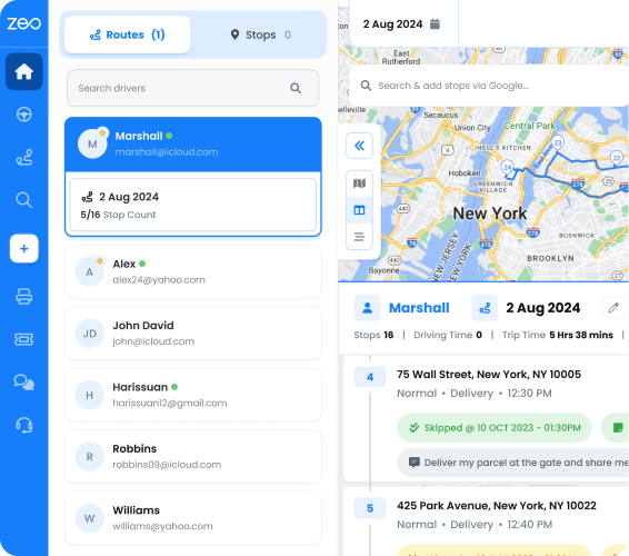
- Average 24% efficiency improvement maintained through year two
- ROI increased from 285% (year one) to 340% (year two)
- Employee turnover decreased 18% in departments using route optimization
- Citizen satisfaction scores improved consistently over 24 months
Year two often brings additional benefits not measured in initial implementations. Driver stress decreases with predictable, efficient routes. Maintenance costs drop as vehicles experience less wear from optimized driving patterns.
Emergency response capabilities improve significantly. Route optimization systems enable rapid deployment during natural disasters, infrastructure failures, and public safety incidents. Real-time coordination prevents duplicate responses and ensures comprehensive coverage.
Zeo's leiðargreiningar identify performance trends that manual tracking misses. Fleet managers receive detailed reports showing which routes consistently exceed time estimates, enabling proactive adjustments before efficiency degrades.
Budget planning becomes more accurate with 24+ months of route optimization data. Agencies can confidently project fuel costs, maintenance schedules, and staffing requirements based on verified performance patterns.
The Department of Transportation reports that government fleets using route optimization show 20-30% better preventive maintenance compliance. Optimized routes reduce vehicle stress and enable more predictable maintenance scheduling.
Budget Approval Toolkit: ROI Metrics and Grant Writing Templates for Route Optimization Projects
Budget committees approve technology investments that demonstrate clear financial returns and risk mitigation. Route optimization proposals need specific metrics and implementation timelines.
Essential ROI Calculations:
- Current fuel costs per vehicle per month
- Average overtime hours attributed to inefficient routing
- Vehicle maintenance costs related to excessive mileage
- Staff time spent on manual route planning activities
Present implementation as a phased approach rather than department-wide deployment. Pilot programs provide proof of concept while minimizing financial risk. Start with 10-15 vehicles to establish baseline metrics.
Federal grant opportunities exist for government technology modernization. The Infrastructure Investment and Jobs Act includes provisions for fleet efficiency improvements. Route optimization qualifies as eligible technology under many grant programs.
Grant Application Components:
- Baseline efficiency measurements and improvement targets
- Environmental impact projections from reduced fuel consumption
- Public service enhancement through faster response times
- Long-term cost savings benefiting taxpayer value
Zeo Route Planner veitir leiðarhagræðing stjórnvalda agencies with detailed ROI calculators and compliance documentation that supports grant applications and budget proposals. The platform’s proven track record with 1.5M+ users across 150+ countries demonstrates enterprise reliability.
Implementation support includes change management resources for government environments. Training materials, employee communication templates, and performance tracking tools ensure successful adoption across municipal departments.
Success requires measuring results that matter to budget committees. Focus on taxpayer savings, service improvement, and regulatory compliance rather than technical features. Present route optimization as essential infrastructure for modern government operations.
Algengar spurningar
Sp.: Hvaða arðsemi fjárfestingar geta ríkisstofnanir búist við af hugbúnaði fyrir leiðabestun?
Government agencies typically see 20-30% efficiency improvements within the first year, translating to $150,000-$300,000 annual savings for medium-sized fleets. Zeo Route Planner’s AI-powered optimization has helped municipal agencies save 2+ hours daily per vehicle, with some reporting over $500K in combined savings.
Q: How long does it take to implement route optimization in government fleets?
Most government implementations follow a 3-6 month phased approach, starting with a 30-day pilot program covering 10-15 vehicles. Full department rollouts typically complete within 90 days, with employee adoption rates reaching 85-90% when proper change management is implemented.
Sp.: Hvaða kröfur verða leiðabestunarkerfi stjórnvalda að uppfylla?
Government route optimization systems must comply with FISMA security requirements, including data encryption, role-based access controls, and audit trails. The system should also provide automated reporting for federal audits and maintain detailed records of vehicle usage for transparency and accountability purposes.
Q: Can route optimization work across multiple government departments?
Yes, cross-department coordination can reduce fleet sizes by 20-25% while maintaining service levels. Zeo’s unified platform enables different departments to share vehicles and coordinate routes during emergencies or peak demand periods, maximizing resource efficiency across the entire municipal operation.
Sp.: Hvaða mælikvörðum ættu ríkisstofnanir að fylgjast með til að mæla árangur leiðabestunar?
Key performance indicators include fuel cost reduction, overtime savings, service response times, citizen satisfaction scores, and vehicle maintenance costs. Agencies should also track environmental impact metrics like CO2 reduction and compliance documentation efficiency to demonstrate comprehensive taxpayer value.
Ready to build your route optimization budget proposal? Request a government compliance demo and ROI calculator to demonstrate measurable taxpayer value through efficient fleet operations.
Ert þú flotaeigandi?
Viltu stjórna bílstjórum þínum og afhendingu auðveldlega?
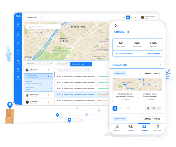
Stækkaðu fyrirtækið þitt áreynslulaust með Zeo Routes Planner - fínstilltu leiðir og stjórnaðu mörgum ökumönnum á auðveldan hátt.
auka eldsneytissparnað
Sparaðu 2 tíma á afhendingu, daglega!
Fínstilltu leiðir með reikniritinu okkar, dragðu úr ferðatíma og kostnaði á skilvirkan hátt.
Komdu í gang fyrir frjáls