
# Government Route Optimization Case Study: Real ROI Results
> TL; DR: Three government agencies achieved $2.7 million in combined savings through strategic route optimization, with implementation completed in under 90 days each. Manual route planning wastes 23% more on fuel and maintenance than necessary, costing mid-sized fleets over $2 million annually. Route optimization platforms like Zeo Route Planner address this with AI-powered optimization and real-time GPS tracking, helping government teams save 2+ hours daily while improving citizen services.
Government fleets face mounting pressure to do more with less while maintaining transparency for taxpayer dollars. Manual route planning across departments creates inefficiencies that drain budgets and reduce public service quality. This government route optimization case study examines real implementations that delivered measurable savings and improved citizen services.
The numbers tell a compelling story. Three government agencies achieved combined savings of $2.7 million through strategic route optimization, with implementation completed in under 90 days each.
The $2.3M Problem: How Manual Route Planning Drains Government Budgets
Government fleet operations hemorrhage taxpayer money through inefficient routing practices. According to the Stjórnarflotasamtök, the average government fleet spends 23% more on fuel and maintenance than necessary due to poor route planning.
Consider a typical city with 150 vehicles across five departments. Manual route planning creates cascading inefficiencies:
Daily operational waste accumulates quickly. Drivers spend 45-60 minutes each morning planning routes manually. With 150 drivers earning an average of $22 per hour, this planning time alone costs $247,500 annually.
Eldsneytissóun compounds the problem. Poorly planned routes increase daily mileage by 15-25%. A fleet consuming 50,000 gallons annually at $3.20 per gallon wastes $10,000-$16,000 yearly on unnecessary fuel.
Viðhaldskostnaður escalate from excess mileage. Additional wear on 150 vehicles averaging 25,000 miles annually adds $187,500 in premature maintenance costs, based on Department of Transportation fleet data.
Service delivery suffers when routes aren’t optimized. Citizens wait longer for permit inspections, utility repairs, and social services. Poor service delivery creates liability exposure and political pressure that’s difficult to quantify but costly to address.
The total annual impact: $2.3 million in preventable costs for a mid-sized government fleet.
Case Study 1: Metro Water Department Cuts Fuel Costs by 35% While Improving Response Times
Metro Water Department operated 85 service vehicles responding to 300-400 daily service calls across a 500-square-mile service area. Manual dispatch created significant inefficiencies.
The Challenge
Dispatchers used paper maps and tribal knowledge to assign service calls. The process took 90 minutes each morning. Emergency repairs often sent technicians crisscrossing the service territory, increasing response times and frustrating customers.
Monthly fuel costs averaged $28,000 for the fleet. Customer complaints about slow response times reached the city council, creating political pressure for improvement.
Innleiðingarferli
The department implemented route optimization software in phases over 60 days. Week one focused on training dispatchers and field supervisors. Weeks two through four involved pilot testing with 20 vehicles. Full deployment occurred in week eight.
Zeo Route Planner’s AI-powered optimization reduced daily planning time from 90 minutes to 15 minutes while automatically considering technician skills, parts inventory locations, and emergency priority levels.
Mælanlegar niðurstöður
Fuel costs dropped 35% within three months, saving $9,800 monthly. Annual fuel savings reached $117,600.
Average response time for non-emergency calls decreased from 4.2 hours to 2.8 hours. Emergency response time improved from 47 minutes to 31 minutes.
Customer satisfaction scores increased from 3.2 to 4.6 (out of 5) in post-service surveys with improved sönnun fyrir afhendingu skjöl.
Arðsreikningur
Total implementation cost: $24,000
Annual savings: $147,000 (fuel + labor efficiency)
Endurgreiðslutími: 2.1 mánuðir
Three-year ROI: 1,837%
Case Study 2: County Social Services Increases Daily Client Visits by 40% with Same Staff
Regional Social Services Department struggled to serve 1,200 clients requiring home visits across a rural county spanning 800 square miles. Twelve case workers averaged 3.2 visits daily, falling short of state-mandated service levels.
The Challenge
Case workers spent 65% of their workday driving between appointments. Manual scheduling created inefficient routes that wasted time and limited client contact hours.
State compliance requirements mandated specific visit frequencies for different client categories. The department faced potential funding cuts for missing service targets.
Stefnumótandi framkvæmd
The department implemented route optimization with careful attention to compliance requirements. The system considered mandatory visit frequencies, client availability windows, and case worker specializations.
Implementation occurred during a planned system upgrade, minimizing disruption. Training emphasized how optimized routing supported compliance objectives rather than replacing case worker judgment.
Real-time GPS tracking provided audit documentation for visit times and locations, addressing state oversight requirements.
Skjalfestar niðurstöður
Daily client visits increased from 3.2 to 4.5 per case worker, a 40% improvement. Monthly client contact hours increased from 960 to 1,344 across the department.
Drive time decreased from 65% to 45% of the workday, allowing case workers to spend 20% more time with clients.
State compliance scores improved from 78% to 94%, securing continued funding and avoiding potential penalties.
Fjárhagsleg áhrif
No additional staffing required to meet service targets, avoiding $180,000 in planned new hires. Fuel costs decreased 22%, saving $15,000 annually.
Total annual value: $195,000 in avoided costs and improved service delivery.
Multi-Agency Government Route Optimization Case Study: How Regional Coordination Saved $400K Through Shared Route Intelligence
Five county departments – water utilities, code enforcement, building inspections, waste management, and parks maintenance – coordinated route optimization across 120 vehicles serving overlapping geographic areas.
Samhæfingaráskorun
Each department planned routes independently, despite serving the same neighborhoods. Multiple county vehicles often visited identical areas on different days, missing opportunities for efficiency.
Citizens complained about constant disruption from various county services appearing throughout the week instead of coordinated visits.
Unified Implementation Approach
The county implemented shared route optimization across departments while maintaining operational independence. Each department retained control over scheduling and priorities while sharing geographic intelligence using AI-knúin leiðarhagræðing.
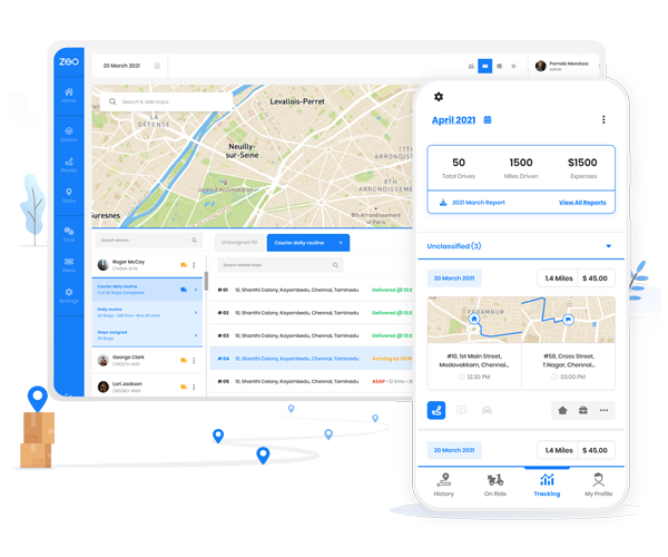
Field workers across different departments used the same mobile platform to receive optimized routes and provide real-time updates. Water technicians, code enforcement officers, and social workers all accessed the Zeo mobile app for turn-by-turn navigation and status updates, enabling seamless coordination without complex integrations.
Cross-Department Results
Total mileage decreased 18% across all departments, saving $65,000 annually in fuel and maintenance costs. Administrative time for route planning dropped 67%, freeing supervisors for higher-value activities worth $85,000 annually.
Citizen satisfaction improved significantly. Complaint calls about county service disruptions decreased 45% after implementing coordinated routing.
auka eldsneytissparnað
Vandræðalausar sendingar og afhendingar!
Fínstilltu leiðir með reikniritinu okkar, dragðu úr ferðatíma og kostnaði á skilvirkan hátt.
Komdu í gang fyrir frjáls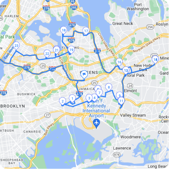
Regional Savings Calculation
Combined fuel and maintenance savings: $65,000 annually
Administrative efficiency gains: $85,000 annually
Avoided duplicate infrastructure visits: $28,000 annually
Reduced overtime from poor planning: $35,000 annually
Heildarárlegur sparnaður: $213,000
Three-year savings: $639,000
Implementation investment: $48,000
Net three-year ROI: $591,000
Government Implementation Roadmap: From RFP to ROI in 90 Days
Government procurement requires structured implementation approaches that address compliance, training, and change management concerns following bestu starfsvenjur fyrir leiðarhagræðingu.
Phase 1: Requirements and Procurement (Days 1-30)
Begin with comprehensive needs assessment across departments. Document current costs, service levels, and compliance requirements. This data supports RFP development and vendor evaluation.
Include key stakeholders early: fleet managers, IT security, procurement, and department heads. Their input shapes requirements and builds implementation support.
Budget considerations should include software licensing, training costs, and potential hardware needs. Most implementations require $150-$300 per vehicle annually for comprehensive route optimization platforms.
Phase 2: Pilot Implementation (Days 31-60)
Start with 20-30 vehicles from one department to validate functionality and identify adjustment needs. Pilot testing reveals integration challenges and training requirements before full deployment.
Focus pilot testing on measurable outcomes: fuel consumption, service times, and driver satisfaction. Document results to support wider rollout and address skeptical departments.
Phase 3: Full Deployment (Days 61-90)
Roll out department by department, applying lessons learned from pilot testing. Stagger implementation to manage change impact and ensure adequate training support using proven flotastjórnunarstefnur.
Monitor key performance indicators daily during the first month. Quick identification of issues prevents problems from becoming embedded practices.
Árangursþættir
Executive sponsorship accelerates adoption and addresses resistance. Change management communication emphasizing improved public service resonates better than cost-cutting messages.
Integration with existing systems requires IT involvement from day one. Most platforms offer APIs for connecting with fleet management, work order, and financial systems.
Compliance and Audit Trail: Meeting Transparency Requirements While Optimizing Operations
Government operations require detailed documentation for audit compliance and public transparency. Route optimization platforms must support these requirements while delivering operational improvements.
Kröfur um skjöl
Government fleets need comprehensive records for fuel usage, vehicle utilization, and service delivery metrics. Automated tracking eliminates manual logging while providing more accurate data according to Bureau af Labor Tölfræði workforce efficiency studies.
Rauntíma GPS mælingar creates audit trails for vehicle locations and service completion times. Photo capture and digital signatures provide proof of service delivery that satisfies oversight requirements.
Time-stamped data shows exactly when services were delivered and routes were completed, supporting performance reporting and citizen inquiry responses.
Transparency Benefits
Detailed analytics demonstrate efficient use of taxpayer resources. Fleet managers can produce reports showing cost per mile, fuel efficiency trends, and service delivery improvements.
Public records requests become easier to fulfill with comprehensive digital documentation. Automated reporting reduces administrative burden while improving data accuracy.
Cost-Benefit Reporting
Zeo Route Planner’s analytics dashboard tracks metrics essential for government reporting: miles driven, fuel consumed, services completed, and response times. This data supports budget justifications and performance reviews.
Monthly reports show ROI progression and help identify additional optimization opportunities. Three years of data reveals seasonal patterns and long-term efficiency trends.
Implementation Accountability
Project success requires clear metrics and regular reporting. Establish baseline measurements before implementation and track improvements monthly.
Share results with department heads and city councils to build support for optimization initiatives. Documented success in one department encourages adoption across other areas.
Regular performance reviews ensure continued optimization and identify new opportunities for improvement. Route optimization delivers ongoing benefits when properly managed and monitored.
Algengar spurningar
Q: How much can government fleets realistically save through route optimization?
Government fleets typically achieve 15-35% savings on fuel and maintenance costs through strategic route optimization. Based on real implementations, a mid-sized government fleet with 150 vehicles can save $400,000-$600,000 annually by reducing unnecessary mileage and improving operational efficiency.
Q: What compliance requirements must government route optimization systems meet?
Government route optimization must provide comprehensive audit trails including GPS tracking data, service completion timestamps, and detailed documentation for transparency requirements. Systems need to generate reports for public records requests and maintain data security standards for taxpayer accountability.
Q: How long does it take to implement route optimization across government departments?
Most government agencies complete route optimization implementation within 60-90 days using a phased approach. This includes 30 days for procurement and requirements, 30 days for pilot testing, and 30 days for full deployment. Zeo Route Planner’s government implementations average 75 days from RFP to full operational status.
Q: Can different government departments share route optimization data while maintaining operational independence?
Yes, departments can coordinate geographic intelligence through shared platforms while retaining control over their scheduling and priorities. This approach allows water utilities, code enforcement, and social services to reduce duplicate travel in the same areas without compromising departmental autonomy.
Q: What ROI should government agencies expect from route optimization investments?
Government agencies typically see payback periods of 2-4 months with three-year ROI exceeding 1,000%. The combination of fuel savings, reduced administrative time, and improved service delivery creates measurable value that supports budget justifications and continued investment in optimization technology.
Ready to explore how route optimization can transform your government fleet operations? Request a government-specific demo and implementation timeline tailored to your procurement process. See how other agencies achieved measurable savings while improving public service delivery.
Ert þú flotaeigandi?
Viltu stjórna bílstjórum þínum og afhendingu auðveldlega?
Stækkaðu fyrirtækið þitt áreynslulaust með Zeo Routes Planner - fínstilltu leiðir og stjórnaðu mörgum ökumönnum á auðveldan hátt.
auka eldsneytissparnað
Vandræðalausar sendingar og afhendingar!
Fínstilltu leiðir með reikniritinu okkar, dragðu úr ferðatíma og kostnaði á skilvirkan hátt.
Komdu í gang fyrir frjáls